Between two seas
Walking around rural Istanbul


A new urban project in Istanbul takes walkers around the city’s outskirts as a way to document and engage its ongoing transformation.
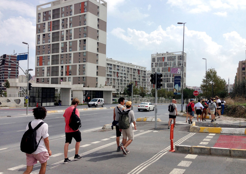
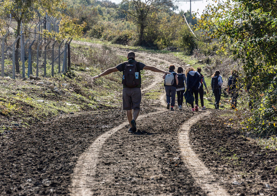
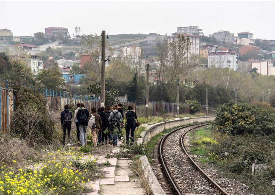
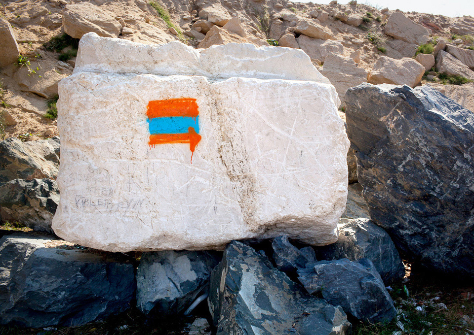
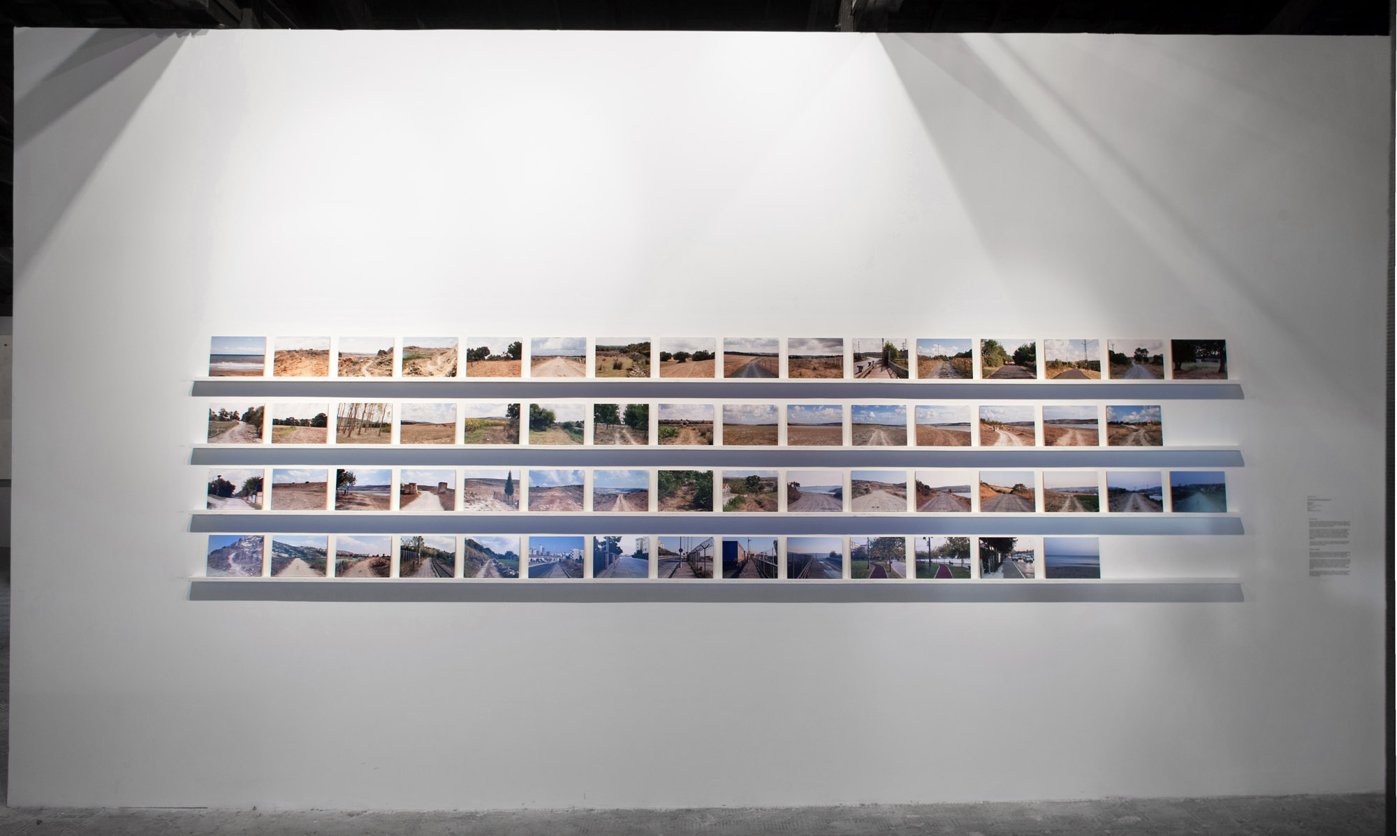
Right after the Gezi protests in 2013, Istanbul-based photographer and artist Serkan Taycan initiated Iki Deniz Arası (Between two seas), a project aimed at telling Istanbulites about the rapid pace of their city’s urban development. With four mapped routes, Iki Deniz Arası invites you to experience Istanbul through walking along a 60 kilometres trail on the city’s western outskirts. All in all it can make a four days hike, starting at the Black Sea coast and ending at the Marmara Sea. The trail goes through natural and agricultural lands, industrial and commercial areas, gated communities and construction sites. At first, the project was showcased at the 2013 Istanbul Biennial as a map and a series of photos. Since then, Taycan has led multiple groups along the trail, discovering another Istanbul.
Can you tell us about how Iki Deniz Arası began?
I started to work on urban issues in 2008 with a photographic project called Habitat, showing landscapes and portraits from Anatolia, the main heartland of Turkey, in order to problematise issues of identity and belonging in non-urban areas. That’s how I began to look at different rural provinces, with the hope to better understand the urban dynamics of the geography around us.
Then, around 2010, when the urban population for the first time in world history had surpassed the rural one – this has been called “the beginning of the urban millennium” – issues concerning Istanbul’s urbanism started to take an even more considerable role in my life. I began to study cities and developed a will to demonstrate these things to a wider audience; some things about living in a city that we all share as part of our everyday life.
I always thought that the most important way to gain an insight about a particular geography is to experience it by walking.

While trying to give meaning to what happened in Istanbul in 2010 and 2011, as the city went through a construction boom, I realised that I was able to understand and draw maps of the city centre but not the transformation of its urban periphery. It was like a laboratory for me, I had a personal curiosity about it. I felt that in order to define the city more precisely, I had to develop a relationship with the periphery. This was the incomplete part of the map that I had in my head, and I had to finish it.
How did you continue after that?
I used to get on a bus and go to outlying parts like Ümraniye, Bağcılar, Sultanbeyli and Beylikdüzü; sometimes even further. I wanted to know how people there mastered difficulties in the city.
During the period leading up to the Gezi protests, the role of the real estate market and Istanbul’s construction economy grew at an unheard pace. Real estate and construction took on a big place in our lives; before, we had not been used to hear about them – at least I had not. So all that happened was something new for me. I began to ask, “What are the different social relationships, dynamics and economic networks at play? How does the geography change? What kind of a life will come out of this?” I wondered about these questions and tried to find answers in the urban landscape.
I felt that in order to define the city more precisely, I had to develop a relationship with the periphery. This was the incomplete part of the map that I had in my head, and I had to finish it.
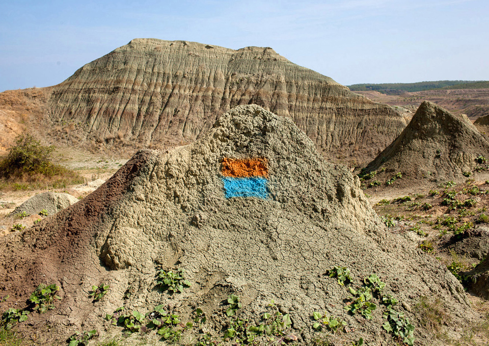
As I went further, to the far ends of neighbourhoods on the periphery, I realised the importance of quarries and how the urban development could be seen through them. For instance, in places we now think of as central, such as Kartal, there once were quarries too. Right before the protests began in Istanbul, the presence and gradual disappearing of quarries around the Gazi neighbourhood started to draw my attention. I prepared the photo project Kabuk (Shell), focusing on quarries and construction sites. It was exhibited in January 2013, a few months before the outbreak of Gezi.
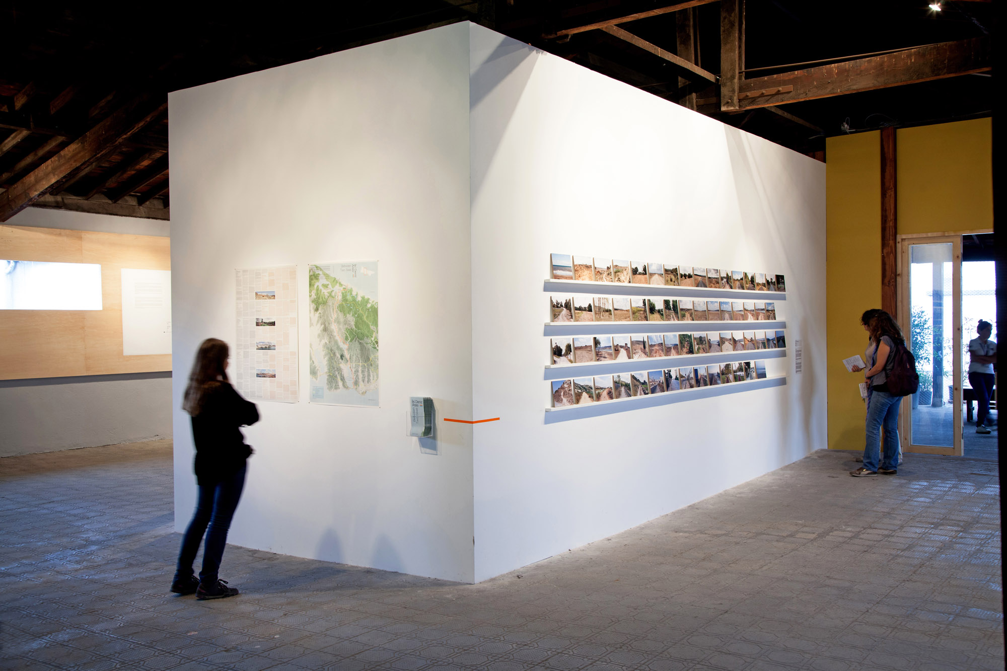

I made a booklet for Kabuk, which included mapping of transportations, bus numbers and other things. People started to ask me if these were real places, the correct distances. I mean, I got questions like, “Can we really go to these places within 15 minutes from Taksim?”. I said that, of course it was possible, the places are easy to reach. These questions led me to Iki Deniz Arası, which began in September 2013.
Iki Deniz Arası is a walking route project. How would you describe it?
First of all, the project would not have emerged without the Gezi grassroots. A “right to the city” mentality emerged, and after the protests, I wanted to underline that. Shared experiences are important and meaningful in a city, I think they can make urban dwellers understand their city and their own place in it. The walking routes I created are a way to do that. I would like everyone in Istanbul to do them, I always thought that the most important way to gain an insight about a particular geography is to experience it by walking.

I have walked routes like the Lycian Way in Turkey and a French Grande Randonnée footpath. That route in particular had a huge influence on me. In Marseille, when the city had been chosen the European capital of culture in 2013, there was this idea to increase walking in the peripheral areas by creating trails. I began considering whether it would be possible to do the same thing in Istanbul, but at that time, all pieces of the puzzle had not fallen into place yet. Not until Kanal Istanbul [Erdogan’s mega project of a canal that, in case it will be completed, will double the Bosphorus strait], stepped in. When I saw the possible route of the canal, I realised it went along the same places that I had photographed for people to experience through walking. I understood how important these areas could become.
When I saw the possible route of Kanal Istanbul, I realised it went along the same places that I had photographed for people to experience through walking.

As the work with Iki Deniz Arası continued, what did it come to mean to you?
What motivates me most is the possibility of walking around the city with different people, and appreciate doing that. In Istanbul, we often feel that we live in a problematic city; we complain about not being in touch with nature. But we do not take into account the peripheries and their potential for bonding people with nature. Almost no one goes to enjoy a day off in these areas, even people who live close. Istanbul, a city populated with 15 million people, has no walking routes.
In Istanbul, we often feel that we live in a problematic city; we complain about not being in touch with nature. But we do not take into account the peripheries and their potential for bonding people with nature.
Do you have any expectations from the participants?
No, I don’t, just them being there and experiencing is enough. The map can be bought from a bookstore and the walks can be done individually as well, by taking the map and using public transport, bringing a sandwich and a bottle of water. The path goes from rural areas or villages to the urban periphery; from the urban periphery to public housing; from public housing to the urban centre. It is my function to be the facilitator, to let people experience urbanisation gradually. Actually, my dream before Iki Deniz Arası was to compress the entire urban history of the area into a an experience that would take four days, walking at a slow rhythm.